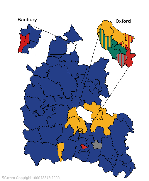
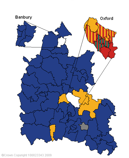
The maps below compare the political landscape of Oxfordshire before and after the 2009 elections. Hover your mouse over the divisions to see the names, click on them for detailed results from the 2009 county council elections.

Before

Political map of Oxfordshire before 2009 elections

After

Political map of Oxfordshire after 2009 elections

Abingdon North Abingdon East Abingdon East Carterton South West Witney East Didcot Ladygrove Didcot South Witney West Bicester Banbury Ruscote Banbury Hardwick Henley South Abingdon West Wallingford East Oxford East Oxford East Oxford Grove & Wantage Banbury Neithrop Banbury Neithrop North Hinksey & Wytham North Hinksey & Wytham North Hinksey & Wytham Kennington & Radley Banbury Easington Banbury Easington Banbury Easington Barton & Churchill Cowley & Littlemore Cowley & Littlemore Cowley & Littlemore Kidlington & Yarnton Leys & Lye Leys & Lye Isis Thame & Chinnor Bicester South Wootton Wootton Wootton Wootton Wootton Wootton Bloxham Banbury Grimsbury & Castle Headington & Marston Headington & Marston Hanborough Hanborough Goring Henley North & Chilterns Henley North & Chilterns Summertown & Wolvercote West Central Oxford West Central Oxford West Central Oxford Chipping Norton Faringdon Faringdon Sonning Common Sonning Common Sonning Common Wheatley Sutton Courtenay & Harwell Dorchester & Berinsfield Benson Benson Burford & Carterton North East Moreton Eynsham Eynsham Eynsham Eynsham Chalgrove Wychwood Kingston Bagpuize Deddington Deddington Charlbury Charlbury Hanneys & Hendreds Hanneys & Hendreds Otmoor & Kirtlington Bampton Bampton Wroxton Ploughley Ploughley Watlington Watlington Woodstock Woodstock Shrivenham Shrivenham Shrivenham Shrivenham